|
In my last blog we looked at Desk-Based Assessment, the usual first link in the process of commercial archaeology preceding a development. There are several ways to continue forward from the DBA, the easiest (for the developer) is when the assessment strongly indicates either nothing archaeological is likely or that the modern disturbance will have already annihilated anything of archaeological interest, in this case no further work may be required. However, this is rare. More often the next step will be one of three things; an archaeological watching brief (if nothing much is expected), a trial trench evaluation (if there is reason to suspect archaeological remains), or geophysical survey (if ground conditions are suitable and a significant amount of archaeology is expected). In this blog post we’ll look at geophysical survey as the results of this survey often lead to further archaeological involvement of the other types, which I’ll get to in future posts. Geophysics then. Let us start at the very beginning, what is it? In short it provides a way of seeing below the ground without digging it up. A kind of X-ray for the earth. Anyone reading who is old enough to remember Time Team, or has watched the re-runs on various channels will recall the geophysics team plodding up and down fields with their gizmos and producing what looked like a heavily pixelated graphic that may or may not show a wall or something. The technology has come a long way since then and a number of commercial archaeology units now have their own equipment, though specialist archaeological geophysics companies also exist as geophysics and archaeology are separate disciplines. 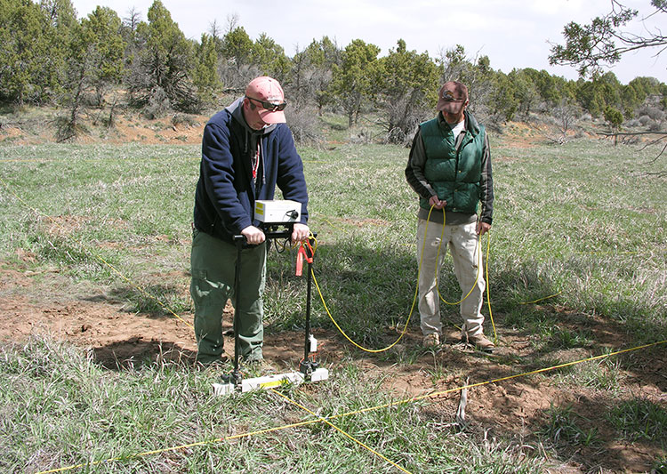 Resistivity Survey, courtesy of CrowCanyon.org There are several different types of geophysical survey that can be used for archaeological purposes, Resistivity, Magnetometery, Ground penetrating radar (GPR), Lidar, and sonar. Sonar is only used for marine archaeology which is something completely different and involves all of its own specialisms and techniques. GPR is probably the best known type of geophysical survey although is not necessarily widely used for archaeological purposes as there are limited conditions in which it can be used effectively. Lidar, (optical remote sensing using laser pulses) is slowly becoming more common as more parts of the country undergo Lidar survey, however it remains largely prohibitively expensive for commercial companies to conduct Lidar surveys of site. Should a Lidar survey of the area in question be already available then the Lidar data tends to be utilised as part of the Desk-Based Assessment. For archaeological purposes resistivity and magnetometer surveys are favoured. Resistivity surveys were certainly common when I was on student excavations in the early 2000’s, although the trend these days is for magnetometer use. However, both are worth looking at as they work in different ways and each is better suited to a particular type of archaeological feature. Resistivity surveys have been used on sites for several decades and were introduced as archaeological tools to the general public by the aforementioned Time Team (I’d certainly never heard of it before watching John Gater and his team trudge the fields). The survey equipment tends to look like a metal frame wrapped in bits of white plastic pipe, with two or four spikes along the base, attached to a battery pack, (or at least that’s what the last one I used on a student dig back in the early 2000’s looked like – I suspect it was a homemade one). The resistivity survey works on the principle that damp ground conducts electricity faster as there is less resistance to the current. A resistivity meter attached to the electrodes (spikes) measures the varying degrees of resistance during the survey. So, ditches, where the soil retains moisture, will allow a current to pass through relatively easily, whereas something solid like a wall, will slow it down. It works really well for ditches and pits in well-draining geology like chalk and gravel. Downside is, this is really slow, and the kit is really heavy. 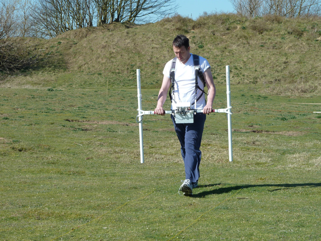 Magnetometer survey, image from Bamburgh research project Which is why magnetometer surveys have become increasingly common in the commercial sector, where time is a huge factor as developments tend to move quickly (or at least they want all the archaeology done yesterday). Though be warned the magnetometer comes with its own problems. Point 1, users can not be wearing anything metal. So goodbye steel toe caps, farewell zippers, lose the underwire bra, earrings, wedding rings and any other metal you may have, or if you’re anything like me and are surrounded by your own personal EMP just stay well away from them. I’m serious, I can’t touch the things, the magnetic reaction is like dropping a demon in holy water or putting a magnet next to a floppy disk (wow that makes me sound old!) and the whole survey comes out blank. Lucky me. There are a few different types of magnetometer but for archaeological purposes we usually use a gradiometer with two sensors (as opposed to a single sensor), because archaeology tends to be close to the surface in areas where we would undertake the survey, and the two sensors provides better resolution at shallow depths. So what does it actually do that makes it better for commercial archaeology than the resistivity survey? For starters it can be used in a variety of conditions, although like most equipment (and archaeologists for that matter) it tends not to like the rain too much. The survey can rapidly cover a large area, as there is no need to stick probes in the ground. The magnetometer detects metals, specifically reacting strongly to steel and Iron, but will also detect burnt or fired materials such as brick, scorched earth (hearths), pottery kilns and certain types of rock which are highly magnetic, however it can also be used to detect smaller things like decayed organics or disturbed soils if magnetic rock formations are not present – hence its usefulness to archaeology. 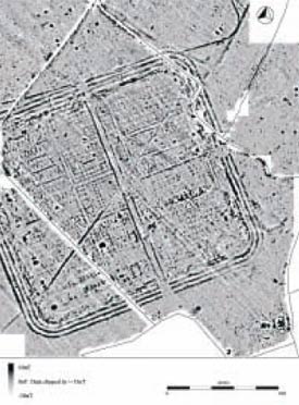 Geophysical survey of Llanfor fort, Gwynedd .©Gwyneddd Archaeological Trust So why do we undertake geophysical survey? Once the survey has been done and the data processed, a geophysical survey can give us a good idea of what is lurking under the ground, which helps inform the next step. If we can see what looks like several ring ditches and a load of other potential features, a geophysical survey gives us targets to dig – thus informing the location of evaluation trenches (see my next blog post, subscribe and be sure not to miss it!). If the geophysical survey detects little, then we may go forward with a more limited watching brief on the area (more on those later too). A desk-based assessment was our first stop to obtain a history of the area from maps and records, a follow up geophysical survey is telling us whether or not there are potential archaeological features under the ground, not only that but the geophysical survey gives us an indication of what type of features we are looking at, ring ditches are a good indicator of prehistoric settlement, square shaped enclosures may suggest Romans, long regular lines are likely to be medieval ridge and furrow. Critically the survey allows us to give the developer an estimate on how long we might need on site and the type of excavation that we will be required to do, which informs the cost of the project, both for us and for them. Geophysics also prepares the site supervisor for getting boots on the ground and pointing the big yellow trowel in the right direction. Having an idea of what you’re looking for and a rough plan of where you might find certain features is very useful. 
1 Comment
In my line of work as a commercial field archaeologist I have to be prepared to deal with various types of site in terms of date range and intended development but we also have multiple methods of determining what sort of archaeological survey to undertake on any given site. In the next few blog posts I’m going to run through each type of archaeological survey that we undertake, where it fits in the planning process and what it means for a development. And so, we will start at the beginning. Desk-based Assessment The Desk-Based Assessments (DBA) sometimes referred to as an Historic Environment Assessment (HEA) are generally the first step in the archaeological aspect of the planning process. They may not always be requested as, if an area is being heavily developed a previous DBA may have already covered the area of the site in question. For the most part a DBA is the beginning of the archaeological side of the planning process and if there is not already a HEA or DBA in place it will be the first thing that a town or county archaeological planning officer will request as part of the considerations on which archaeological conditions will be attached to planning permission. This is relevant to any development whether a huge 200+ housing development, a golf course, or in some cases an extension (house extensions are heavily dependent on the area in which you live and not everything will always apply – covering the planning process is a whole different ball game). A Desk-Based Assessment is pretty much what it sounds like. We do a little research into the development area to see what type of previous activities are recorded. One of the first places we go to is the Historical Environmental Record (HER) various aspects of which are available online via an approved gateway and in (some) local and/or regional libraries or county/town council offices or archives. The homepage is here searchable by region/town. And will give the interested individual all the information they need about who to contact and where the HER database can be accessed. Within the HER itself we can find details of all previous archaeological excavations and assessments within a radius (usually 5km) of the intended development. This gives us a basis to work from as we can see which historical periods tend to dominate the area – for example some areas of Oxford are heavily Roman, whilst others have yielded very little Roman material but may have been used more during the Saxon period. So, we get a feel for the area. 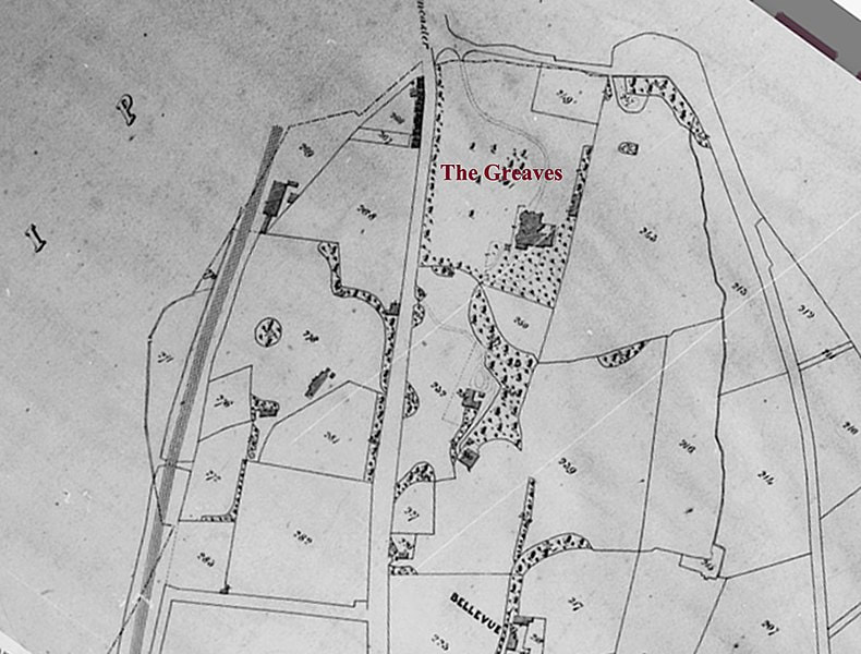 1844 Tithe Map of Greaves Park, Lancaster - Source the Tithe Maps of Lancashire (wikimediacommons) Ordnance survey maps, also available through the HER and local libraries can show us the progression of activity on the site itself whether buildings were there, what the landscape was like, but these obviously only go back to the mid 19th century. Depending on the region we sometimes find that Tithe maps (taxation maps) are available and these, whilst not accurate in terms of scale, can indicate the function of a portion of land. Written records are important too and it may come as a surprise to know that we still consult the 1069 Domesday book for a lot of sites. This is an important document as it details explicitly the citizenry, functionality and wealth of a town or village often with other useful tidbits like this village was passed to this lord for services rendered to the king, or this land was gifted to the church for X reason. Another valuable source is the Victoria County History (VCH) available online here. It does not cover the whole country but gives the known historic background to various towns and cities. On occasion ancient texts may be employed, however these can be notoriously unreliable though the Romans did produce some useful itineraries such as the Peutinger Table which maps the road routes of the empire from India to Britain and survives as a medieval copy. Though these days we tend to consult Margary’s 1955 detailed study, mapping and projecting lines of the Roman roads of Britain, should we be trying to track one down, or see how close to one our site may be. 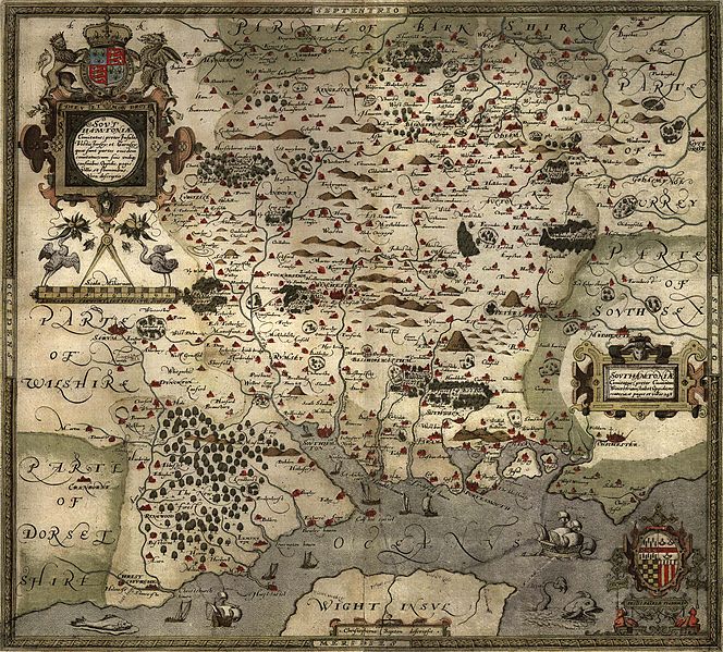 Saxton's 1575 map of Hampshire (Image from WikimediaCommons) As part of the investigation we will also check the geological maps of the area. All available online as part of the British geological survey. The geology itself can sometimes give us an indication of what me might find – for instance raised gravel beds tend to have been preferred spots for prehistoric peoples of Mesolithic to Bronze Age date to pause or settle, so even if there is limited evidence in an area the geology itself may indicate a potential for archaeological remains based on what we understand of the habits of ancient peoples. Chalk will always show archaeological features clearly however remains such as bone are unlikely to survive. Clays and alluvial layers can be deep and may require careful examination as alluvial layering can hide early features below natural deposits. Also the nature of the landscape itself can be informative. Archaeological remains are more likely to survive intact in areas where there has been little development – though little development may also mean little to no chance of remains as the land was never used. We take all these things into account when creating our desk-based assessment. So, a desk-based assessment – basically it is like a college research paper, detailing the likelihood of archaeological remains and their potential date(s) and importance to the area should they be found. It is this document that is used by the planning archaeologist within the county or borough to determine what (if anything) the next phase of archaeological process will be. Believe it or not there are a few cases where the desk-based assessment will be the only archaeological research done for a site. This occurs only if it is felt to be conclusive that there is little to no chance of archaeological remains being present in the area. Usually however it goes something like this: Say our desk-based assessment discovered that the portion of land scheduled for development lay in an area within 5km of a Saxon settlement discovered through previous archaeological investigation. 2km from a second century small Roman villa/ farmstead (these can often be found in close proximity to others). Perhaps field walking in the 1960’s recovered two third century Roman coins and a prehistoric hand axe from the site itself, and the field lies just outside the known core of a village mentioned in Domesday as being of some substance and industry. This would warrant further archaeological investigation and depending on the landscape we would either move directly to archaeological trial trenching or potentially to a geophysical survey. Geophysical survey is now becoming much more common and I will cover it in the next blog post. 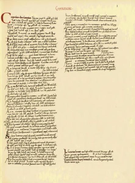 The entry for Cheshire in the Domesday Book. (image from wikimediacommons)  |
S. M. PorterProfessional archaeologist and author, S. M. Porter loves history, adventure and digging in the mud. Her career is in ruins - just where she wanted it to be. Archives
June 2023
Categories
All


|

 RSS Feed