|
My day in archaeology: Dodging the bad guys, sneaking into the map room and waiting for the sun to rise whilst clutching my staff, knowing that the bad guys are digging in the wrong place. The sun rises and strikes the crystal in the staff, slowly (with the accompaniment of dramatic music) a dot of light crosses the map and tah-dah, bursts into brighter white light illuminating the correct place to dig for the buried treasure that awaits.
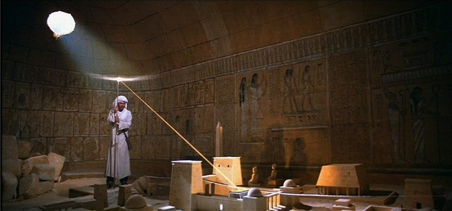
Not quite the day job - image is screen grab from Indiana Jones and the Raiders of the Lost Ark
Not really, that’s just the scene from Indiana Jones and the Raiders of the Lost Ark that set me on the path to a career in archaeology. The real day job, Commercial Archaeology or Developer Led Archaeology to give it its proper name is the process of archaeological mitigation undertaken as part of planning permission criteria ahead of development, such as new housing, new roads, railways, quarrying and so on. It is also occasionally referred to as rescue archaeology, which is technically inaccurate and makes it sound more rapid and more exciting than perhaps it really is. Oh and, no bullwhips on site!
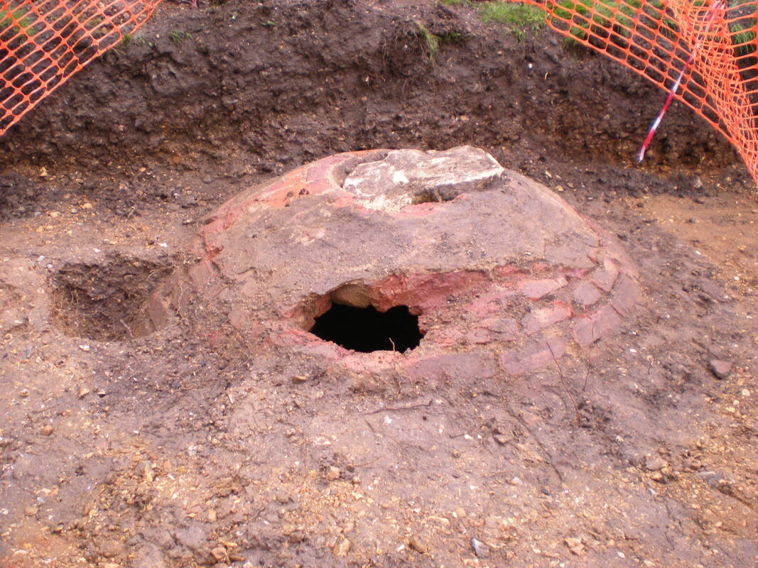
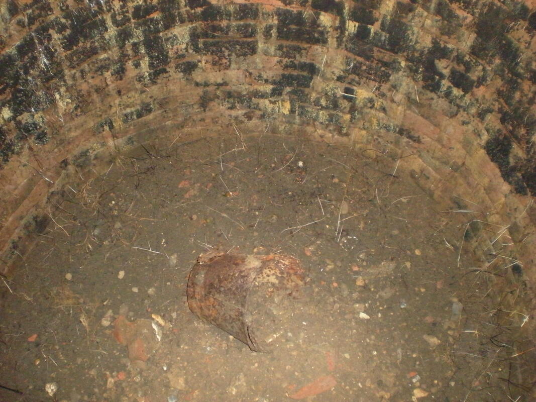
Our objective as commercial archaeologists is to preserve archaeological remains ‘by record.’ This means that we make copious notes and plans about what is there before the development truncates and redesigns the land, forever removing the archaeological remains. Remember archaeology is a destructive process itself in that once we’ve dug something out, we have irretrievably damaged it. Sure, the ditch may still exist but the stratigraphic layers within it have been removed as part of our recording process. Just occasionally we will come across remains important enough to be preserved in-situ, which means that the development plans may have to change to ensure that the archaeology remains in the ground – see my previous blog post on Scheduled monuments for an example of how we deal with this. I have only one example of a development being changed to accommodate archaeology – I was undertaking an archaeological watching brief on a new house footprint in Burnham when we came across an intact bottle well. Not phenomenally old (late post-medieval) but interesting and we could see the metal bucket still inside. The owner of the site was really excited by this and got onto his architects straight away to see if the building wall could be moved a little and a transparent floor put in, so that the well could be a part of his conservatory. The report is published online and can be found here: http://tvas.co.uk/reports/pdf/BHB12-17ra.pdf
This however is not something that happens very often and I could tell you tales of Medieval brew houses and Roman farm buildings now lost forever below housing developments. Their only remains within the pages of my written reports and the finds that we recovered from the site.
This is what preservation by record means. The site itself no longer exists, but we can reconstruct the whole thing thanks to our extensive recording. We plan every feature on a full site plan, either digitally with a gps unit or with good old-fashioned paper and pencil at a 1:50 scale with our grid pegs tied into ordnance datum. We record every feature we dig, giving it cut and fill numbers. From the differential layering of dirt within the features we can tell if the feature was deliberately backfilled or if it silted up gradually over time – we can also tell this with a feature like a ditch by how sharp or eroded the break of slope is. A sharp slope was likely opened and closed within a short space of time however a wider slope may indicate a level of erosion suggesting a long use life. We record all of this on context sheets, detailing colour, consistency, percentage of inclusions and more on each sheet for each number. We will also draw a scaled section at 1:10 to show the build-up of layers within any feature. 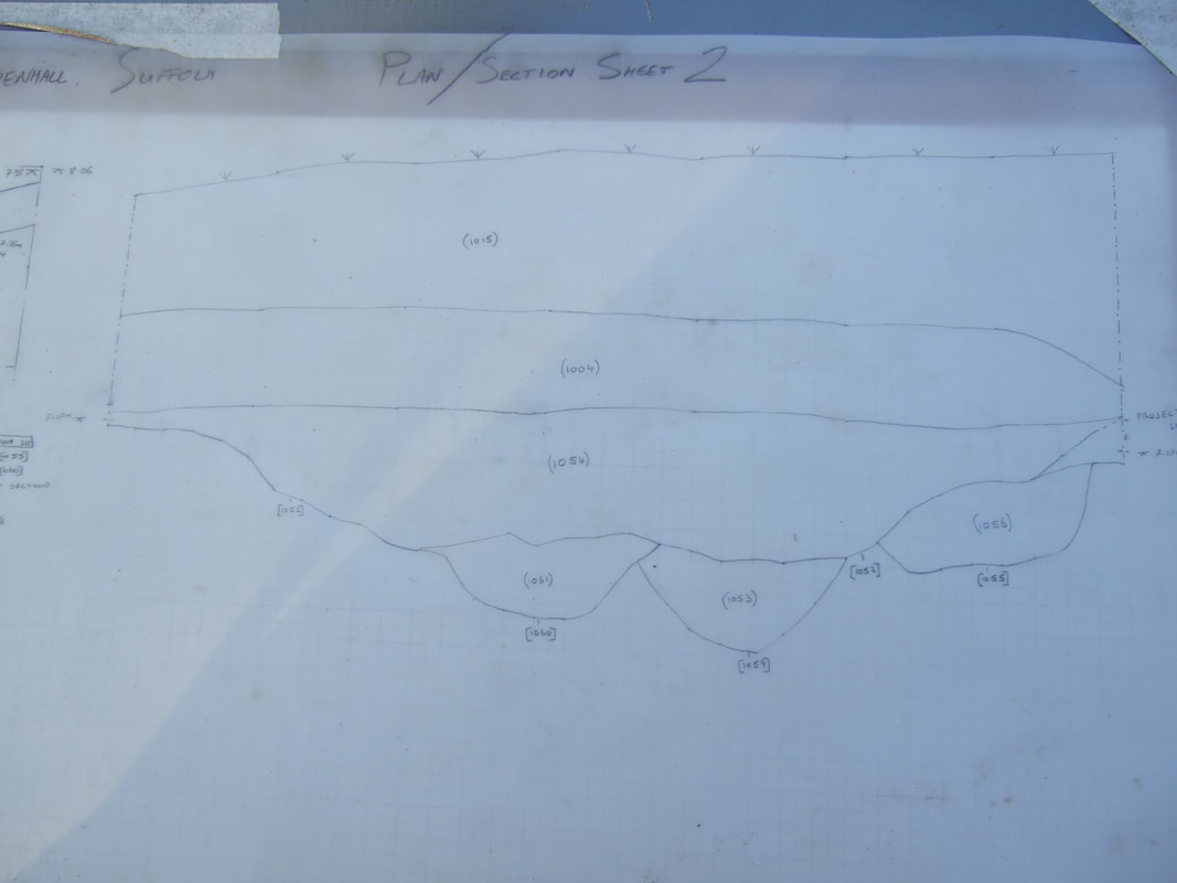
Example of a section drawing showing four ditches below a subsoil deposit
We collect as many finds as we can, logging them to the features and layers that they came from and assigning them to the site archive so that they can be found again – really special finds like coins get their own small find number too.
Once we have all of this material we can assess the finds and date the site thus creating the story of the site which we can distil into a readable report detailing the interesting features and finds in chronological order and explaining how the land use changed over time. And, as our whole archive survives and is placed in storage with local museums of archive stores anyone who wants to look at our material should be able to do so, provided access can be arranged. As such if another site close to one of ours brings new material to light, our initial findings are available to be reassessed even though the archaeology itself no longer remains in the ground. In this way, we ensure that the history of the country continues to be understood, analysed and preserved whilst not preventing developmental progress. It’s not always ideal, and yes it can be a little heart-breaking when you’re on site long enough to see the developers’ machines begin work on one end when you are still finishing off the other, (sometimes it does feel like Indy’s rolling boulder). For those of us who love history however, it allows us to preserve it for future generations, who will no doubt judge us for our primitive methods as much as we do those who came before us. Who knows perhaps one day there will be a way to both preserve archaeology in situ and still use the land for development. 
0 Comments
|
S. M. PorterProfessional archaeologist and author, S. M. Porter loves history, adventure and digging in the mud. Her career is in ruins - just where she wanted it to be. Archives
June 2023
Categories
All
|

 RSS Feed