|
In my last blog we looked at Desk-Based Assessment, the usual first link in the process of commercial archaeology preceding a development. There are several ways to continue forward from the DBA, the easiest (for the developer) is when the assessment strongly indicates either nothing archaeological is likely or that the modern disturbance will have already annihilated anything of archaeological interest, in this case no further work may be required. However, this is rare. More often the next step will be one of three things; an archaeological watching brief (if nothing much is expected), a trial trench evaluation (if there is reason to suspect archaeological remains), or geophysical survey (if ground conditions are suitable and a significant amount of archaeology is expected). In this blog post we’ll look at geophysical survey as the results of this survey often lead to further archaeological involvement of the other types, which I’ll get to in future posts. Geophysics then. Let us start at the very beginning, what is it? In short it provides a way of seeing below the ground without digging it up. A kind of X-ray for the earth. Anyone reading who is old enough to remember Time Team, or has watched the re-runs on various channels will recall the geophysics team plodding up and down fields with their gizmos and producing what looked like a heavily pixelated graphic that may or may not show a wall or something. The technology has come a long way since then and a number of commercial archaeology units now have their own equipment, though specialist archaeological geophysics companies also exist as geophysics and archaeology are separate disciplines. 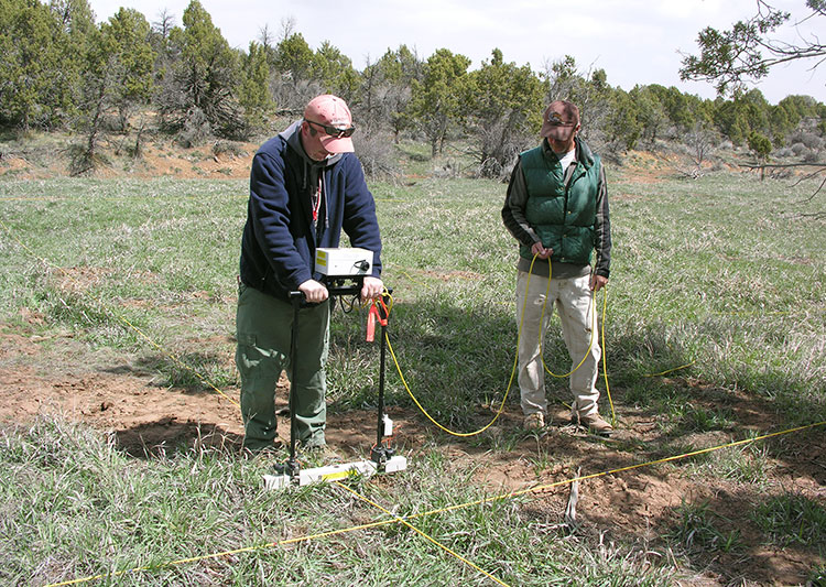 Resistivity Survey, courtesy of CrowCanyon.org There are several different types of geophysical survey that can be used for archaeological purposes, Resistivity, Magnetometery, Ground penetrating radar (GPR), Lidar, and sonar. Sonar is only used for marine archaeology which is something completely different and involves all of its own specialisms and techniques. GPR is probably the best known type of geophysical survey although is not necessarily widely used for archaeological purposes as there are limited conditions in which it can be used effectively. Lidar, (optical remote sensing using laser pulses) is slowly becoming more common as more parts of the country undergo Lidar survey, however it remains largely prohibitively expensive for commercial companies to conduct Lidar surveys of site. Should a Lidar survey of the area in question be already available then the Lidar data tends to be utilised as part of the Desk-Based Assessment. For archaeological purposes resistivity and magnetometer surveys are favoured. Resistivity surveys were certainly common when I was on student excavations in the early 2000’s, although the trend these days is for magnetometer use. However, both are worth looking at as they work in different ways and each is better suited to a particular type of archaeological feature. Resistivity surveys have been used on sites for several decades and were introduced as archaeological tools to the general public by the aforementioned Time Team (I’d certainly never heard of it before watching John Gater and his team trudge the fields). The survey equipment tends to look like a metal frame wrapped in bits of white plastic pipe, with two or four spikes along the base, attached to a battery pack, (or at least that’s what the last one I used on a student dig back in the early 2000’s looked like – I suspect it was a homemade one). The resistivity survey works on the principle that damp ground conducts electricity faster as there is less resistance to the current. A resistivity meter attached to the electrodes (spikes) measures the varying degrees of resistance during the survey. So, ditches, where the soil retains moisture, will allow a current to pass through relatively easily, whereas something solid like a wall, will slow it down. It works really well for ditches and pits in well-draining geology like chalk and gravel. Downside is, this is really slow, and the kit is really heavy. 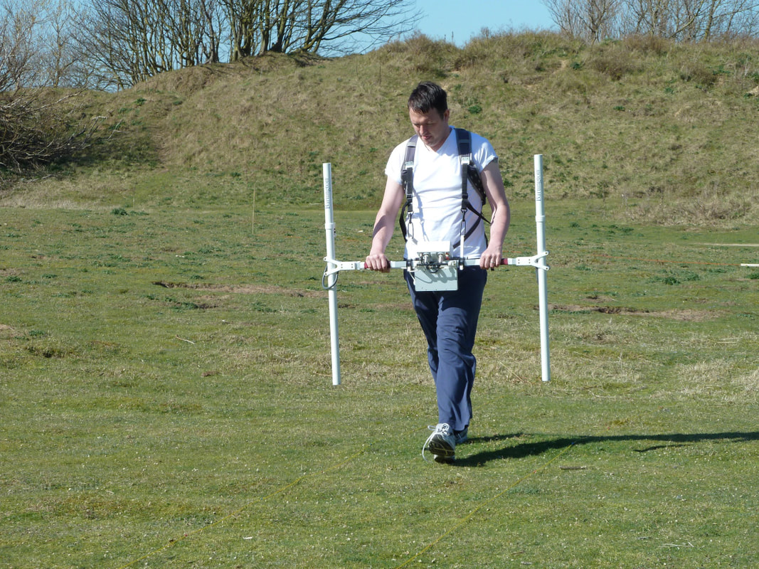 Magnetometer survey, image from Bamburgh research project Which is why magnetometer surveys have become increasingly common in the commercial sector, where time is a huge factor as developments tend to move quickly (or at least they want all the archaeology done yesterday). Though be warned the magnetometer comes with its own problems. Point 1, users can not be wearing anything metal. So goodbye steel toe caps, farewell zippers, lose the underwire bra, earrings, wedding rings and any other metal you may have, or if you’re anything like me and are surrounded by your own personal EMP just stay well away from them. I’m serious, I can’t touch the things, the magnetic reaction is like dropping a demon in holy water or putting a magnet next to a floppy disk (wow that makes me sound old!) and the whole survey comes out blank. Lucky me. There are a few different types of magnetometer but for archaeological purposes we usually use a gradiometer with two sensors (as opposed to a single sensor), because archaeology tends to be close to the surface in areas where we would undertake the survey, and the two sensors provides better resolution at shallow depths. So what does it actually do that makes it better for commercial archaeology than the resistivity survey? For starters it can be used in a variety of conditions, although like most equipment (and archaeologists for that matter) it tends not to like the rain too much. The survey can rapidly cover a large area, as there is no need to stick probes in the ground. The magnetometer detects metals, specifically reacting strongly to steel and Iron, but will also detect burnt or fired materials such as brick, scorched earth (hearths), pottery kilns and certain types of rock which are highly magnetic, however it can also be used to detect smaller things like decayed organics or disturbed soils if magnetic rock formations are not present – hence its usefulness to archaeology. 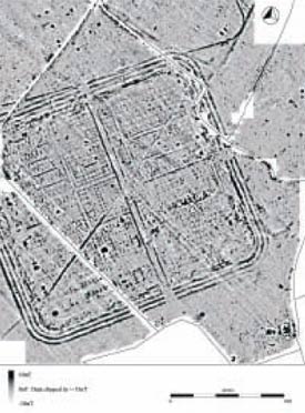 Geophysical survey of Llanfor fort, Gwynedd .©Gwyneddd Archaeological Trust So why do we undertake geophysical survey? Once the survey has been done and the data processed, a geophysical survey can give us a good idea of what is lurking under the ground, which helps inform the next step. If we can see what looks like several ring ditches and a load of other potential features, a geophysical survey gives us targets to dig – thus informing the location of evaluation trenches (see my next blog post, subscribe and be sure not to miss it!). If the geophysical survey detects little, then we may go forward with a more limited watching brief on the area (more on those later too). A desk-based assessment was our first stop to obtain a history of the area from maps and records, a follow up geophysical survey is telling us whether or not there are potential archaeological features under the ground, not only that but the geophysical survey gives us an indication of what type of features we are looking at, ring ditches are a good indicator of prehistoric settlement, square shaped enclosures may suggest Romans, long regular lines are likely to be medieval ridge and furrow. Critically the survey allows us to give the developer an estimate on how long we might need on site and the type of excavation that we will be required to do, which informs the cost of the project, both for us and for them. Geophysics also prepares the site supervisor for getting boots on the ground and pointing the big yellow trowel in the right direction. Having an idea of what you’re looking for and a rough plan of where you might find certain features is very useful. 
1 Comment
In my line of work as a commercial field archaeologist I have to be prepared to deal with various types of site in terms of date range and intended development but we also have multiple methods of determining what sort of archaeological survey to undertake on any given site. In the next few blog posts I’m going to run through each type of archaeological survey that we undertake, where it fits in the planning process and what it means for a development. And so, we will start at the beginning. Desk-based Assessment The Desk-Based Assessments (DBA) sometimes referred to as an Historic Environment Assessment (HEA) are generally the first step in the archaeological aspect of the planning process. They may not always be requested as, if an area is being heavily developed a previous DBA may have already covered the area of the site in question. For the most part a DBA is the beginning of the archaeological side of the planning process and if there is not already a HEA or DBA in place it will be the first thing that a town or county archaeological planning officer will request as part of the considerations on which archaeological conditions will be attached to planning permission. This is relevant to any development whether a huge 200+ housing development, a golf course, or in some cases an extension (house extensions are heavily dependent on the area in which you live and not everything will always apply – covering the planning process is a whole different ball game). A Desk-Based Assessment is pretty much what it sounds like. We do a little research into the development area to see what type of previous activities are recorded. One of the first places we go to is the Historical Environmental Record (HER) various aspects of which are available online via an approved gateway and in (some) local and/or regional libraries or county/town council offices or archives. The homepage is here searchable by region/town. And will give the interested individual all the information they need about who to contact and where the HER database can be accessed. Within the HER itself we can find details of all previous archaeological excavations and assessments within a radius (usually 5km) of the intended development. This gives us a basis to work from as we can see which historical periods tend to dominate the area – for example some areas of Oxford are heavily Roman, whilst others have yielded very little Roman material but may have been used more during the Saxon period. So, we get a feel for the area. 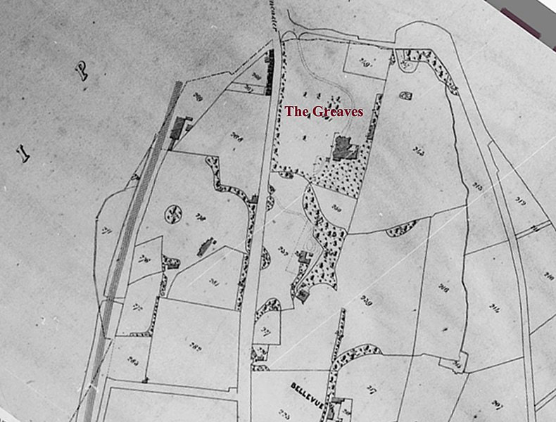 1844 Tithe Map of Greaves Park, Lancaster - Source the Tithe Maps of Lancashire (wikimediacommons) Ordnance survey maps, also available through the HER and local libraries can show us the progression of activity on the site itself whether buildings were there, what the landscape was like, but these obviously only go back to the mid 19th century. Depending on the region we sometimes find that Tithe maps (taxation maps) are available and these, whilst not accurate in terms of scale, can indicate the function of a portion of land. Written records are important too and it may come as a surprise to know that we still consult the 1069 Domesday book for a lot of sites. This is an important document as it details explicitly the citizenry, functionality and wealth of a town or village often with other useful tidbits like this village was passed to this lord for services rendered to the king, or this land was gifted to the church for X reason. Another valuable source is the Victoria County History (VCH) available online here. It does not cover the whole country but gives the known historic background to various towns and cities. On occasion ancient texts may be employed, however these can be notoriously unreliable though the Romans did produce some useful itineraries such as the Peutinger Table which maps the road routes of the empire from India to Britain and survives as a medieval copy. Though these days we tend to consult Margary’s 1955 detailed study, mapping and projecting lines of the Roman roads of Britain, should we be trying to track one down, or see how close to one our site may be. 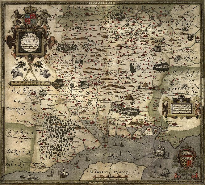 Saxton's 1575 map of Hampshire (Image from WikimediaCommons) As part of the investigation we will also check the geological maps of the area. All available online as part of the British geological survey. The geology itself can sometimes give us an indication of what me might find – for instance raised gravel beds tend to have been preferred spots for prehistoric peoples of Mesolithic to Bronze Age date to pause or settle, so even if there is limited evidence in an area the geology itself may indicate a potential for archaeological remains based on what we understand of the habits of ancient peoples. Chalk will always show archaeological features clearly however remains such as bone are unlikely to survive. Clays and alluvial layers can be deep and may require careful examination as alluvial layering can hide early features below natural deposits. Also the nature of the landscape itself can be informative. Archaeological remains are more likely to survive intact in areas where there has been little development – though little development may also mean little to no chance of remains as the land was never used. We take all these things into account when creating our desk-based assessment. So, a desk-based assessment – basically it is like a college research paper, detailing the likelihood of archaeological remains and their potential date(s) and importance to the area should they be found. It is this document that is used by the planning archaeologist within the county or borough to determine what (if anything) the next phase of archaeological process will be. Believe it or not there are a few cases where the desk-based assessment will be the only archaeological research done for a site. This occurs only if it is felt to be conclusive that there is little to no chance of archaeological remains being present in the area. Usually however it goes something like this: Say our desk-based assessment discovered that the portion of land scheduled for development lay in an area within 5km of a Saxon settlement discovered through previous archaeological investigation. 2km from a second century small Roman villa/ farmstead (these can often be found in close proximity to others). Perhaps field walking in the 1960’s recovered two third century Roman coins and a prehistoric hand axe from the site itself, and the field lies just outside the known core of a village mentioned in Domesday as being of some substance and industry. This would warrant further archaeological investigation and depending on the landscape we would either move directly to archaeological trial trenching or potentially to a geophysical survey. Geophysical survey is now becoming much more common and I will cover it in the next blog post. 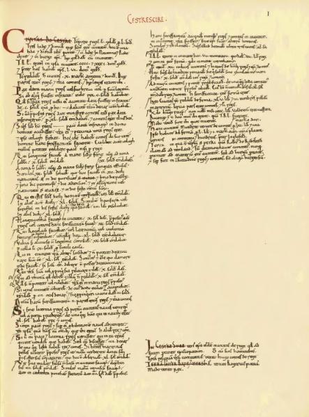 The entry for Cheshire in the Domesday Book. (image from wikimediacommons) 
In the last few blog posts I’ve been waxing lyrical about Rome and the adventures of my fictional characters in their second archaeological adventure, time now to head back to my adventures as a commercial archaeologist. So what have I been dealing with recently?
Dangerous things, I’ve been dealing with dangerous things! My recent sites have included brushes with landfill refuse, hydrocarbon contamination, used needles and everyone’s favourite toxic mineral – asbestos. The asbestos is the one I’m going to elaborate on as a quick internet search and talks with my new dig team indicate that a lot of archaeologists out there have no idea what this stuff looks like, though we all know how dangerous it is. 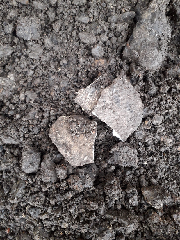
A typical fragment of asbestos cement tile, note the stippled effect and the fibres visible in the fresh break. This is what 90 % of the asbestos I see on site looks like. It can be in bigger fragments of smaller ones, a single piece or a whole cache.
Asbestos was used for everything from the 19th century through to 1999 in the UK. The versatile fireproof, weather proof insulator was mixed up in everything from cement, cardboard, fabric, yarn, paper and even used in Hollywood special effects – remember the snow in the Wizard of Oz, or White Christmas – 100% pure asbestos, also marketed for private home snow decorations. Of course, now we know it contains a whole heap of horrible toxic material that sits in the lungs and causes all kinds of nasties so we all have to stay well clear and cannot use it in buildings anymore, though strangely it is apparently still used in the US and China. But although currently banned in the UK, this stuff is still everywhere – check the ceiling above you right now, is it Artex? That’s a white asbestos mix, don’t go drilling in it without a respirator.
I was working on a building site recently and vaguely expecting the odd bit to show up – we’d done an evaluation on the site and turned up a cache of the stuff in one of the trenches. Sure enough there it was, and oh boy was it a lot. Actually, it was enough for me to haul my team off site immediately and stand down the project until it can be professionally removed. What I’ve found most surprising though is how few archaeologists know what to look for. My current team are fairly fresh out of university and several of them remarked that they had no idea of what asbestos looked like – they do now as we saw plenty, but it struck a chord. Sure, we’ve all done the online asbestos awareness course but the images that we are shown tend to be of nicely rendered asbestos tiles, or cement which is in place, not broken and not decaying. Essentially not how we as archaeologists come across it. 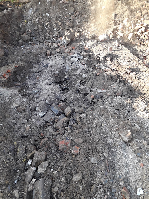
This is an archaeologist's nightmare, lets play spot the asbestos? Can you work out which bits are safe and which are dangerous. I'll give you a hint, everything white is asbestos cement tile in this picture.
When archaeologists find asbestos it is generally because it is buried in the ground – unless you’re doing a building survey but that’s a different issue. There are several reasons for this, most involve either a deliberate burial of the material, something that is illegal now, but still happens and frequently happened in the 70s and 80s on farmland. Other times it can be that we’ve stumbled across something like an old asbestos lined basement, water tank, drainpipe or even an old air raid shelter as some had asbestos cladding, the list goes on.
Anyhow Asbestos is fine when its stable, (your Artex ceiling is fine), the fibres are all encased and nothing is moving anywhere, but break it and those fibres are released. Yep even in the cement stuff. But when the archaeologists find it, the stuff has usually been buried in the ground for several years, and what happens to things in the ground? They decay, same with asbestos, fire retardant it may be, but even it can’t stand up to acidic soil and earthworms. So, when I scrape back a load of subsoil with a 20 ton mechanical excavator, what do I find? Stuff that looks like tile is the most common asbestos cement, though occasionally it can look like flexible grey metal, (think of a corrugated garage roof), it was also used for pipes so if you ever spot a drain pipe that looks a bit like it’s made of cardboard avoid it because you have asbestos. Essentially as an archaeologist, if it doesn’t look like something archaeological (ceramic or brick) and looks a bit odd: its probably asbestos. If you’re close enough to see a cross section, its fibrous composition is clear. 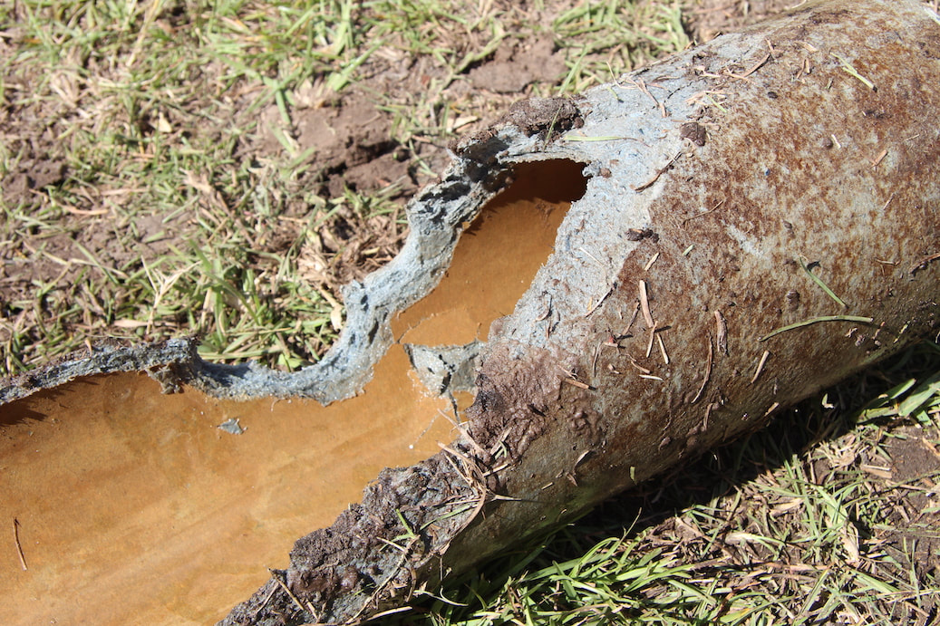
I pinched this image from the Brunswick-Glynn Joint Water and Sewage Comission webpage I hope they don't mind, but it was the best example of an asbestos pipe looking a bit like papier-mâché that I could find.
Actions: If possible, cover it up with plastic sheeting, clear the area and call the pro’s in to clear it out. As a last resort use the machine again to bury it but mark the position and still call the pro’s out to clear it. Do not tidy it up yourself. And definitely, most certainly: don’t eat it.
As a side note, archaeological studies have discovered asbestos being used by prehistoric people to strengthen ceramic pottery in the stone age. The word Asbestos itself comes from the ancient Greek for unquenchable and Pliny the Younger is widely (if not entirely correctly) thought to have been the first to notice the mineral’s detrimental effect on humans. There are also legends through the ancient world of Persian rulers who could clean their tablecloths by throwing them into the fire. So it’s not just modern asbestos that could prove problematic to the modern archaeologist. It seems humans have been messing around with its fire proof qualities for centuries. Other ancient sources cite asbestos as a cure for skin diseases, although it is possible that they meant soapstone as these terms have often been confused in texts. 
In my last blog post I discussed my adventure into the depths of the Colosseum basement at midnight, following my characters footsteps through their second adventure in Rome. This time I followed my characters to a different part of the city. In Echoes of the Eternal City my team of teenage archaeologists find themselves needing to leave the city, whilst its history hangs in the balance, and head out down the famous Appian Way. Whilst they raced down the cobbled street on Vespa’s with time shifting all around them, I had an altogether more leisurely experience, walking with my husband on a hot and sunny day.
When we were in Rome 10 years ago we rather foolishly tried to do the Appian Way on our last day, wearing our heavy travelling clothes and dragging suitcases. Needless to say it did not go well! We walked across Rome, trekked about half a mile (if that) down the road that we thought was the Appian Way and eventually just gave up, both tired, hot and very grouchy as we couldn’t work out where we were. This time we were sensible and took the bus straight to the Appian Way visitor’s centre opposite the church of Quo Vadis, where according to tradition, St. Peter had a vision of Christ who told him to return to Rome (where he was fairly swiftly executed). Here we collected a very useful map. The Appian way is still a major road out of Rome, at least it is whilst it’s close to the old city gates, a little further along the road splits and a route that looks suspiciously like the private driveway to a church takes pedestrians up the hill towards the first of the catacombs away from the traffic. And as luck would have it, right to the spot where on their return to Rome my teenage characters find themselves in the battle for Rome’s history. 
Overlooking the city gates in the background, the location of the big battle in Echoes of the Eternal City!
From the crest of this hill it was possible to stand and see the gates of Rome to the north and the peaks of the Alban Mountains to the south, the tallest of which, Monte Cavo, is another key location in Echoes of the Eternal City. We continued southwards past the catacombs of St. Callistus, past the church of Saint Sebastian and the second set of catacombs located below the church.
Further south the road has less traffic and in some places still retains its original Roman cobblestones. We did actually watch someone carefully manoeuvre a scooter over them, all I can say having watched someone try it for real is that my fictional team had one hell of a bumpy ride! 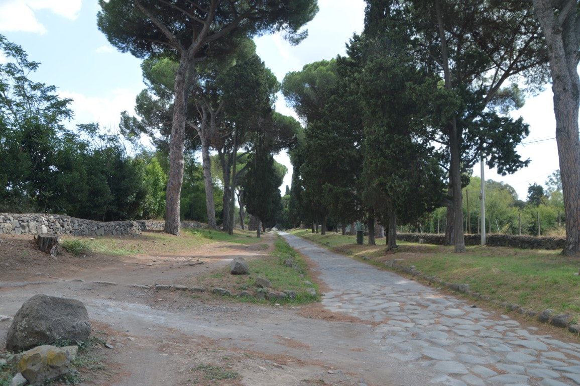
The Appian Way, such an idyllic and tranquil spot, not like it used to be! Note the original Roman cobbles!
Whilst the amble along the Appian way was itself a pleasant enough walk we were delighted to discover a number of well-preserved Roman ruins along the route, one of which was the Imperial residence of Maxentius, emperor of the early 4th century. Whilst most of the villa is inaccessible, Maxentius’ personal Circus is in a much better state of preservation than the more famous Circus Maximus in the city. Here the Spina remained standing for several courses of brickwork, gates and towers were clearly visible, as were the stands and part of the villa to which the whole thing was attached! Now I have villa envy, should I ever sell enough books to build myself a Roman villa I will now have to ensure that I have enough space for a private circus that could hold 10,000 spectators! Within the same grounds as the circus was a mausoleum known as the tomb of Romulus, built by Maxentius to house the remains of his eldest son in 309AD. Next door to this lies the large tomb of the wife of Crassus, (Crassus was one of the triumvirs with Julius Caesar and Pompey – he’s the one who led the ill-fated invasion of Parthia and came to a rather nasty end involving molten gold and his throat), like Viserys in Game of Thrones but more violent). The tomb was later used as a 14th century fortified tower. Another villa, Torre di Capo di Bove, or part of it further to the south was open to observation, with mosaic tiles still in place on the floor.
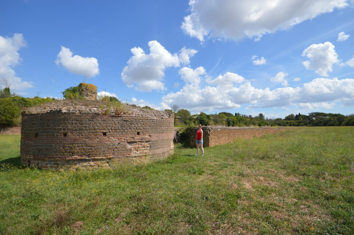
The Circus of Maxentius, with a more complete Spina than the famous Circus Maximus
Every few hundred yards there was something to look at, be it more modern houses (people still live on the via Appia after all) or Roman tombstones from the cemetery that used to flank the route into the city. It was forbidden to bury people inside the city walls during the Roman period and so the roads outside Rome were flanked by tombs for miles in all direction, this made it a good place for thieves and murderers to hang out after dark. In fact, one of Cicero’s early orations was in defence of a man (Milo) accused of murdering another (Clodius Pulcher) on the Appian way outside a tavern. For those who have read Echoes of the Eternal City I will confess that I was enough of a Geek that the body my characters drive past in the road, is supposed to be the murdered Clodius Pulcher.
We passed a pleasant day wandering roughly five kilometres up the Appian way before heading back and investigating the first of the catacombs. The catacombs were a vast maze and without a guide we would surely have wandered there forever. I highly recommend a trip down at least one set of the catacombs, and in fact a day walking or cycling on the Appian Way itself. For those who manage to venture further along the road than I managed there are vast villas, aqueducts and plenty of mausoleums of Roman date to be seen. Should I have the chance to return to Rome I’ll be heading there equipped to attempt a hike of the whole road, perhaps I can even follow my characters and reach Monte Cavo, although there is nothing up there but an aerial mast these days, so I’m told.
For those who follow my Facebook and Twitter feeds this latest blog post will come as no surprise. I recently took some time off work to return to my most favourite place in the world, and setting of my second novel, Rome.
Rome is a special place to me, having studied Roman history all my life, the city is something of a holy grail type place. It is where huge turning points in history occurred, so much history came from, a place that essentially began life as a small tribal village on the edge of a boggy swamp and river. In fact, I once read a text book that described the founding of Rome as “seven hills and one big sewer”. But the city is special for another reason, it happens to be where my husband proposed to me 10 years ago, and no, he didn’t queue up to do it at the Trevi Fountain like everyone else, he took me to the Colosseum. I love the Colosseum. It is a place steeped quite literally in blood, sweat and tears. I’ve seen it before, but never like this: this time it was midnight, there were only 20 people there and we were exploring the lower levels. But a little background first. 
The Colosseum stands in the very heart of Rome and was built by the Emperor Vespasian who assumed the purple (became emperor) following a short civil war after the death of the unpopular Nero. Nero, perhaps most famous for burning half of Rome and blaming it on the Christians, built a huge palace for himself in the centre of Rome complete with a boating lake where the Colosseum now stands. Needless to say Vespasian tore down Nero’s golden palace and built a public monument in its place thus making him far more popular with the people of Rome than Nero had ever been. (side note: you can tell Vespasian is one of the good emperors as he’s one of only a handful not to have been murdered!). At the time the Colosseum was referred to as the Flavian Amphitheatre, the name Colosseum actually comes from a colossal statue of Nero (later, the god Helios) which stood only meters from one of the Colosseum entrances until the medieval period when the metal was stolen and melted down for other uses.
The building’s survival is also somewhat of an accident. It has long been held that this was the site of the martyrdom and murder of thousands of Christians. Actually this is incorrect – executions usually happened at the Circus Maximus. However it was due to this belief that Christian executions occurred there that the building was initially denounced and later saved thanks to the Church believing its own propaganda. As it was Papal compassion that saved the Colosseum, those of us who love Ancient Rome have to be grateful to religion for preserving such a fantastic monument, even if their reasoning was somewhat incorrect. As a side note it is not impossible that executions were carried out at the Colosseum, however there are no surviving records whilst there are a number of records survive for the executions of Christians in the Circus Maximus. 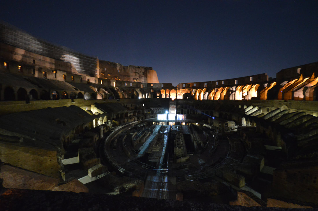
Anyhow on to my own adventure and entering the Colosseum after hours when all the tourists have gone, just like my fictional team of teenage archaeologists. Whilst they broke in through the gladiator school, I entered via a far more legal means as a small tour group.
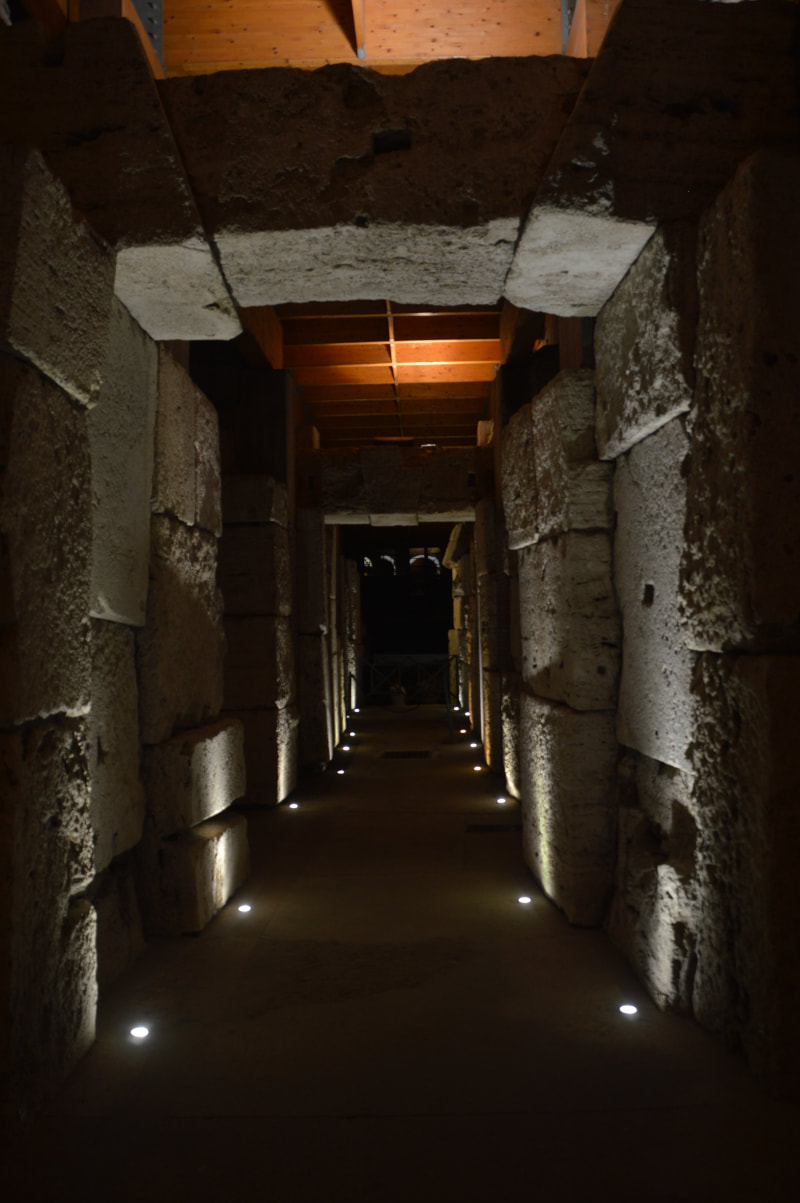
During the day when full of tourists the Colosseum is almost as it was, alive with the sound of people talking, laughing, selling things and going about their day. At night, it is a silent, imposing building, filled with an almost hallowed hush of expectation. An empty theatre after the show. Shadows dance across the stage in the moonlight, swords and tridents appear as shadows on the walls, the battle of the gladiators can almost be heard. Yes, from the upper tiers it is an overwhelming experience as the vast expanse of the place becomes clear. We had the benefit of a full moon, which gave some of our photos the haunting feeling that outside the walls of the Colosseum Nero’s fire was raging. The upper levels of the Colosseum though were not our final destination, we were headed where few can currently go. Into the lower levels. We were walked down some wide stairs, around the inner encircling wall and down more stairs below the losing (read dead) gladiators exit from the arena. Down we went into the darkened tunnels below. There are electric lights there now but the slaves who worked down here and gladiators waiting to go on would have been in near darkness as lamps would have been dangerous with all those wooden beams around.
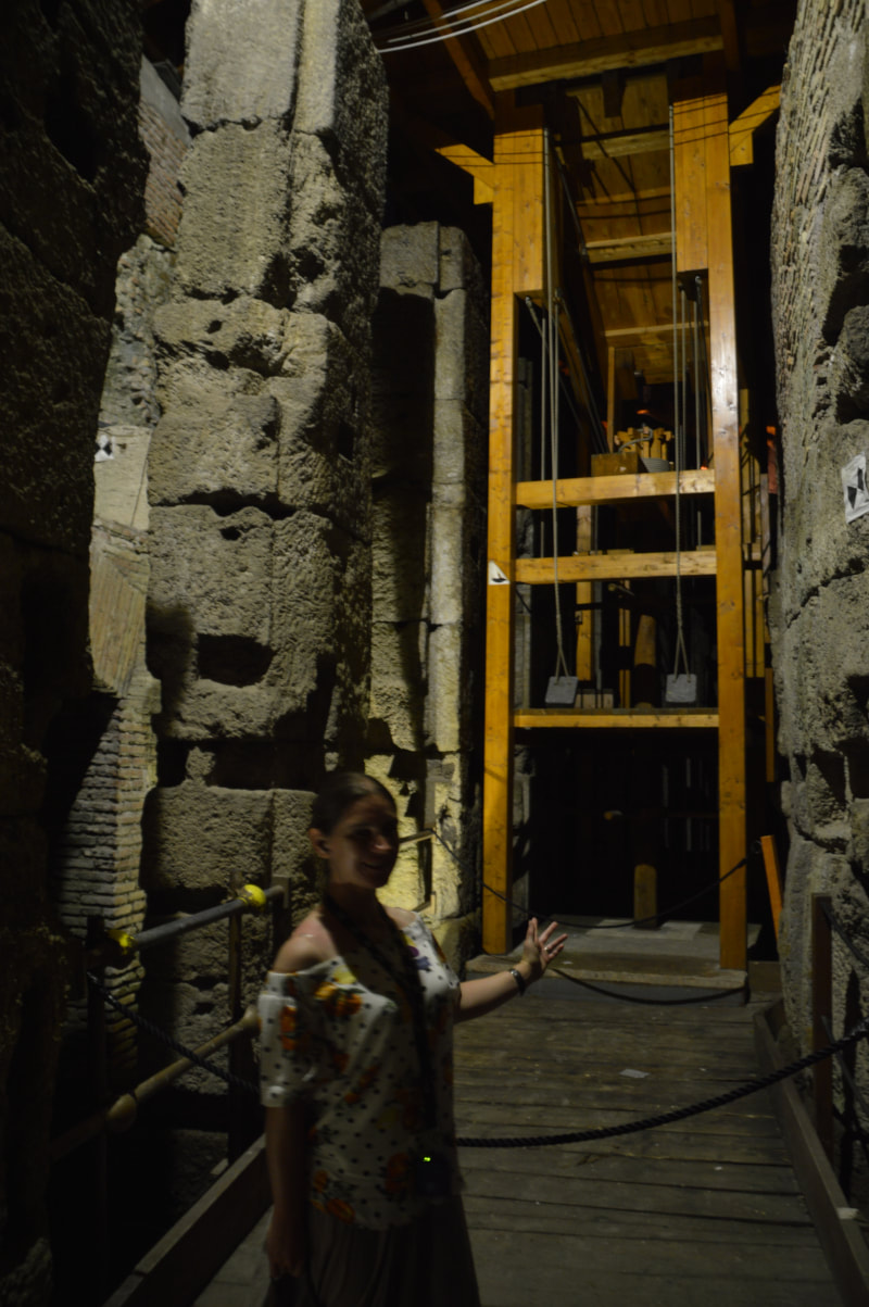
We reached the base of the stairs, as chance would have it right where the passage from the gladiator school joins the underground chambers of the Colosseum. Essentially right where my team of teenagers also entered the Colosseum (although they entered onto the stage for a more dramatic literary effect). It was quiet down there and oddly cold, there was not much open for us to wander around but we were ushered forward below to a portion of the stage that currently indicates the location of the arena floor. Here was a lift. A timber framed lift exactly as described in Echoes of the Eternal City. Here before me was the spot where my characters climbed down into the lower levels where they awoke the ghastly gladiators. There would have been over 40 of these lifts below the floor of the arena for transporting scenery, gladiators and animals – those scenes with the tigers in Ridley Scott’s Gladiator were not wrong!
The animal pens down there were tiny, imagine the poor giraffes and elephants stored down there in the dark. Romans had no real qualms about animal cruelty so tiny pens did not bother them. In all honesty the gladiators did not have much better accommodation anyway. Whilst below ground we could also see the channels created to deal with the latrines, the arena had thousands to cater to its immense audience, and its drains run deep, linking eventually with the sewer system and then to the Tiber via the massive Cloaca Maxima. Finally, we were taken back upstairs, but there was one last thing to do. At midnight I stepped out onto the deserted arena floor and I believe I have never felt so tiny or closed in. To be a gladiator and walk out to a braying crowd must have been terrifying, to walk out below a full moon was moving and intimidating. It is an awe-inspiring building for all the blood soaked into its stones, a symbol of a long dead power with an infinite belief in its own hubris. Whilst it is of course physically impossible to touch and feel the past, standing on the Colosseum floor at midnight with an overactive imagination is the closest I have ever felt to the veil of time being lifted. 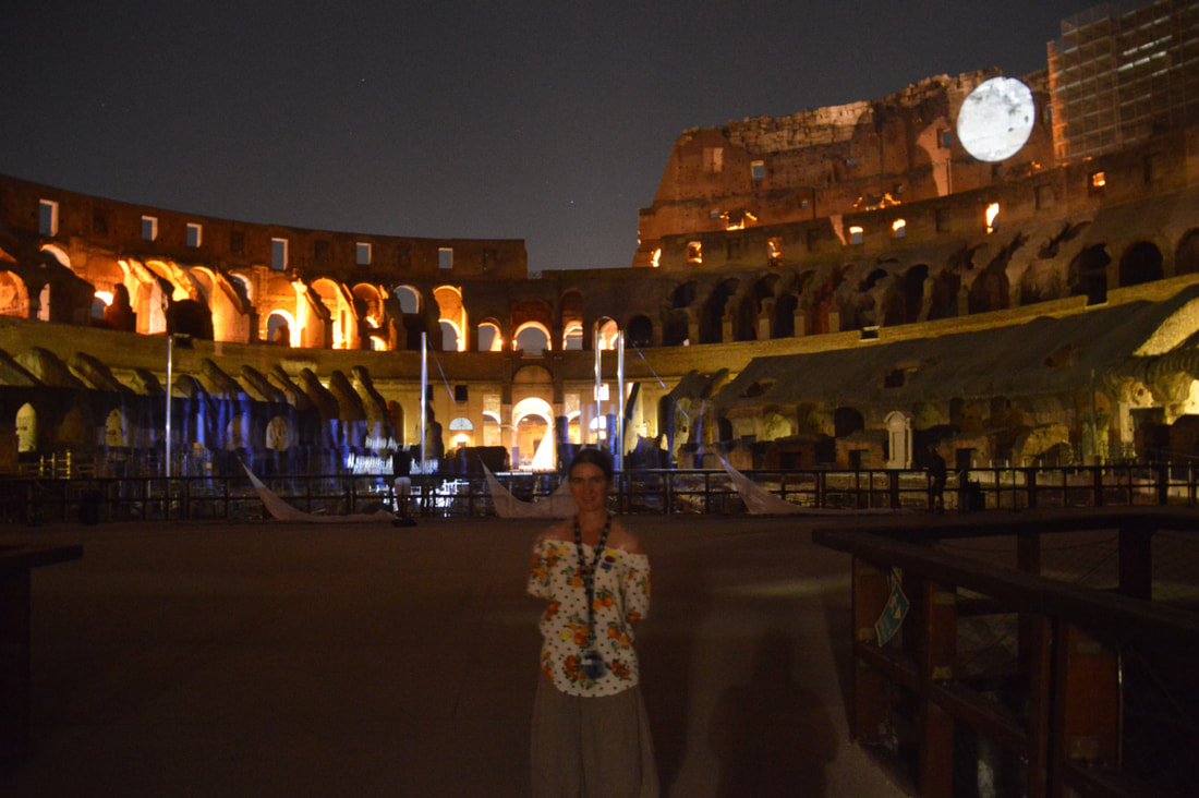
These later night tours of the Colosseum are expensive, but should you be going to Rome I wholeheartedly recommend it, the guides are both historians and archaeologists who really know their subject. The earlier part of the evening takes a tour around the ancient centre of Rome starting from Trajan’s Column, circling around past the Emmanuel Monument (the Wedding Cake) to show visitors the surviving remains of Roman tenement blocks, up past the Capitoline Museum (another location from Echoes) and back down past the Forum, via the arch of Constantine and Temple of Julius Caesar before heading up the main road towards the Colosseum. Our tour began at 9:30 and we left the Colosseum shortly after midnight.
We booked our tour with Viatour, see their website for info.
|
S. M. PorterProfessional archaeologist and author, S. M. Porter loves history, adventure and digging in the mud. Her career is in ruins - just where she wanted it to be. Archives
June 2023
Categories
All
|

 RSS Feed